If you have a problem like this (picture below when you create a new map, for example distance from specifik line or polygon), you are new in ArcGis 😀 like me.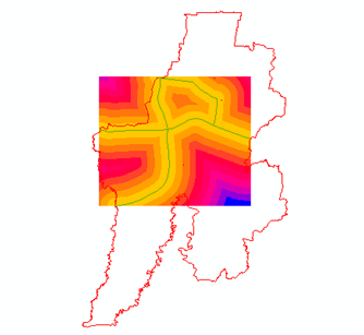
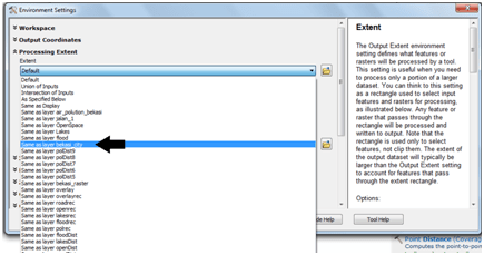
It’s ok, back to euclidean distance toolbox there are environment button that you have to fill.
 You have to fill the processing extent to other map that cover the rectangle of it e.g Bekasi city. Thanks to someone that give the solution in the link here.
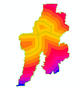
 Do not stop here, you also have to fill in raster analysis form filling Bekasi city as analysis of mask in order to get the exact match like the result below.