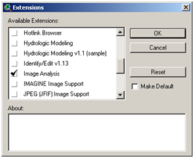
Digitalization is an activity to convert non digital map such as photo, conventional map, and other sources which is raster data type into digital data that contain both spatial and its attribute. We need image analysis tool in Arcview by adding image analysis facility in extensions.
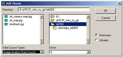
Add the IMAGINE Image Support and JPEG (JFIF) Image Support as well. In our laboratory we have been served with an image of our university and we have to digitalize it. Add a new view with the theme is the image that we want to digitalize.
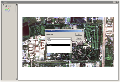
The digitalization process is trying to create a new map that contain vector data and its attribute in a table (in arcview the dbf file is created). By using the image, we simply create a new image by separating the building, road, river, etc in separate layer. There is three kind of vector data that arcview provided, point, line, and polygon. For a particular area we use point, line for roads, and polygon for buildings. We do not need to create new view, just add new theme for making a layer for building, road, river, etc.
For example we want to digitalize buildings, use polygon and draw again every building that we want to digitalize. Do not forget to start editing every the beginning of digitalization action. After all the building that we want to digitalize has finish, add an attribute to its table.
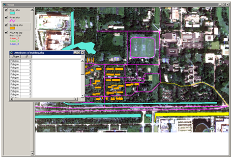
Add the field necessary to your attribute data such as name, description, etc. The final result is a digitalize map that contains a spatial and attribute data, and of course a raster data (main image) can be used as well. Use label for showing a particular object and then create a layout to accommodate this new digital map.

