A constraint is an image that showing allowable and non-allowable locations for modelling. It represents zero for non-allowable and one for allowable. We can add two for incentive, the better location. For example we have a constraint that must be integrated for other constraint, e.g. vegetation. It means that the model do not allow to convert a vegetation into other land cover.
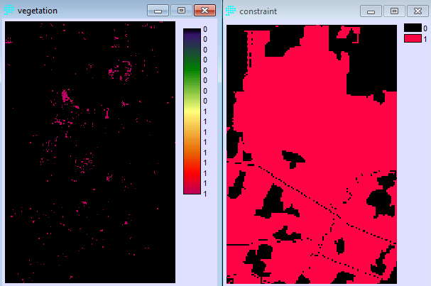
Use Mathematical operation in “GIS analysis” menu and chose “Overlay”. Fill with the two constraint images above and checklist the “First +Second” button in “Overlay option”.

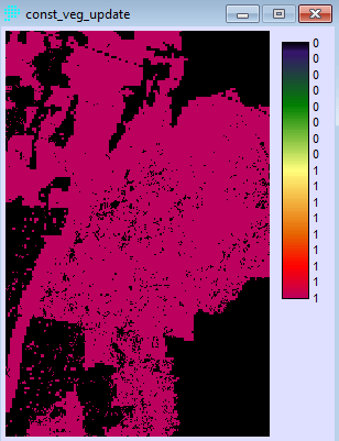
After this operation, we have to convert two into zero, since the vegetation is a constraint. Use “Reclass” to convert it.

The last row will convert two into zero. The final constraint was created as a combination of two constraints (figure below).
Try to practice mathematical operation since it is very useful for image creation, especially in creating Drivers of Land change modeller (LCM). This video shows the step to integrate the two images.
