Geoprocessing is an operation used to manipulate the GIS data. The data can be got from secondary data from government or by directly surveying the location. Sometimes we only want to analysis a particular area but we have retrieved data beyond it. Therefore we need some operations to limit our analysis scope. For example we want to analysis a particular area of north-east Thailand, first the all data is retrieved into a theme. Do not forget to add the extensions, geoprocessing and other needed extensions such as spatial analysis, image analysis, etc.
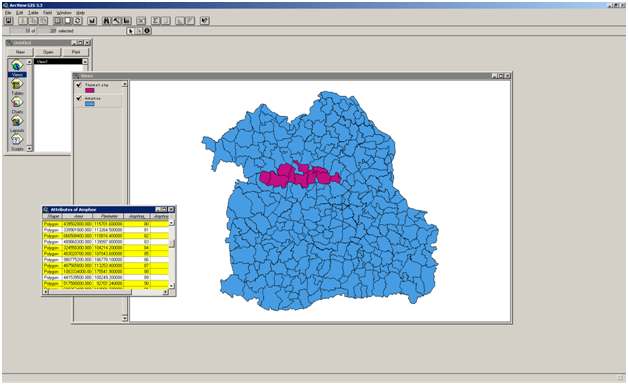
Figure 1
Open its table and select the sub area that you want to analysis by clicking shift and left mouse in the same time. In the picture above we want to analyze only the red area. After finish selecting areas we continue to convert it into other shape files by clicking Theme – Convert to Shapefile. Click yes if you want to add this new shapefile to the view after giving a name for it. Try to integrate this new shapefile to other data such as road, elevation, etc. Use a geoprocessing wizard to manipulate this data because the road data we have already is for north-east area.

Use the clips technique which available in arcview and the result is our sub-region with the road inside it. Try to add some data such as elevation and try to play with spatial analysis e.g. reclassify.

See you ..
