Georefernece is an activity to match the map to coordinate exactly by using some methods such as comparing to google map or by surveying the location on the map and getting the real coordinate by Global Positioning Service (GPS). GPS use some satellites that counting the location of object based on location of the satellite. Because location of the satellite is exactly counted, the location of object must be easily counted, but of course there will be some errors.
We have tried to locate some point on our campus map and try to make our map with the real longitude and latitude coordinate system. First we create a text file from data that we have gotten by GPS. We also use excel for easily typing the data and then save as (convert) into text (delimited text file).
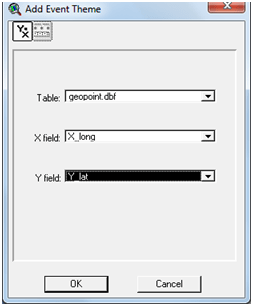
Open the arcview and load the data file for making the theme from this data (event theme). Create new view and followed by clicking View – Add Event Theme. Choose the coordinate of latitude and longitude based on your data.
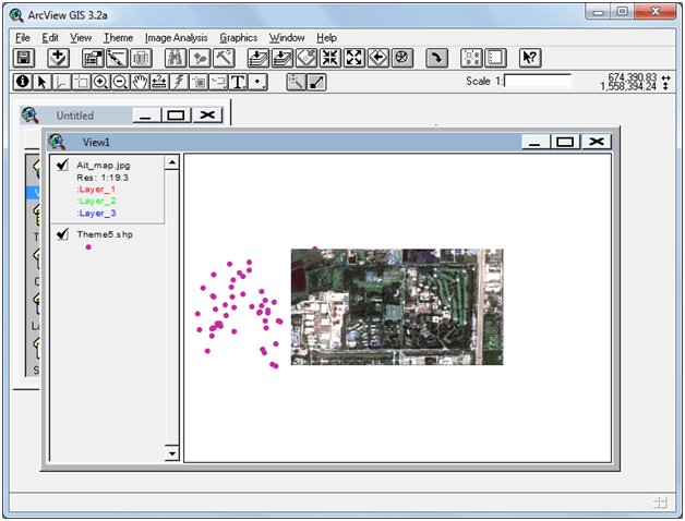
You will see some points that show the coordinate from data/table. This theme is only temporary because after we convert it into shape file, we can delete it from our project. Click Theme – Convert file to Shp. Click yes if you are asked wether add this shape file to the view. Now you can delete of the old event theme.
Now we try to connect the map to this shape file from GPS data. First we have to add facility to image analysis by choosing from File – Extension and thick the image analysis and others that related to image.

I have problem when first time installing the arcview and there are some extention available, so I have to add some AVX file or I just add the Arcview folder from our laboratory’s arcview. Click OK, and add new theme, and chose “Image Analysis” option. Search your map and try to match it to GPS data by using “align” facility.
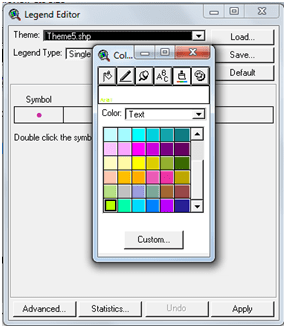
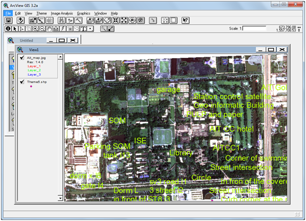
To match the map with GPS coordinate we have to match at least three points in the edge of our map. And we can see the name of point by seeing it using “identify” tool. May be you make an “auto lable” to those point, but first you have to modify the text (colors and size), because the text may be too big for the map. Double click the theme in view to see the legend.
The technique for matching is simple, click the map theme, and then click the “align” tool. Do not forget to click first the location on the map and followed by clicking the point.
You can convert this theme to JPG file or other kinds of layout. Just try it.
