Some thematic maps are useful in LCM as drivers. Roads, rivers, and other important locations can be created using GIS tools, e.g. ArcGIS, ERDAS, QGIS, etc. But elevation and slope which are mainly created from Shuttle Radar Topography Mission (SRTM) can be easily created in IDRISI without other GIS Tools help. By using IDRISI we will easily use the thematic map created without function PROJECT to match with other images.
See how to download SRTM, and how to created slope and elevation map in ArcGIS.
Figure below is elevation map from SRTM. This map must be adjusted both its size and reference using. Whereas sizing use function WINDOW, referencing using Metadata window (below the IDRISI explorer).
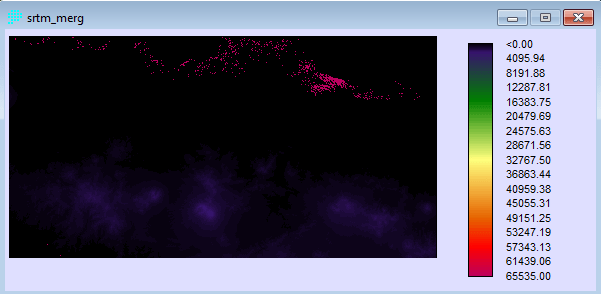
Unfortunately our study area needs two tiles to be downloaded from USGS site. Use WINDOW function to crop this map following the study area.
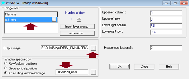
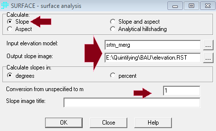
Chose the images to be cropped and the name and location of output image. Fill upper left and right as well as lower left and right. But if you have already a study area map, chose this map in “An existing windowed image” and then press OK. To create slope from the elevation map, use Slope function (just type “slope” in searching menu in IDRISI).
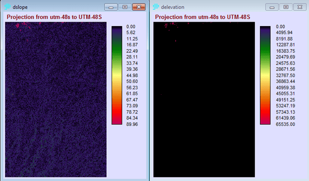
Use again WINDOW function to crop the resulted image according the study area. To match the elevation and slope map, use PROJECT function.